Where should you live in Sofia?
Every one of Sofia's 236 neighbourhoods, scored on the things that decide daily life: transit, parks, schools, noise, prices and what locals actually say. Built on public data.
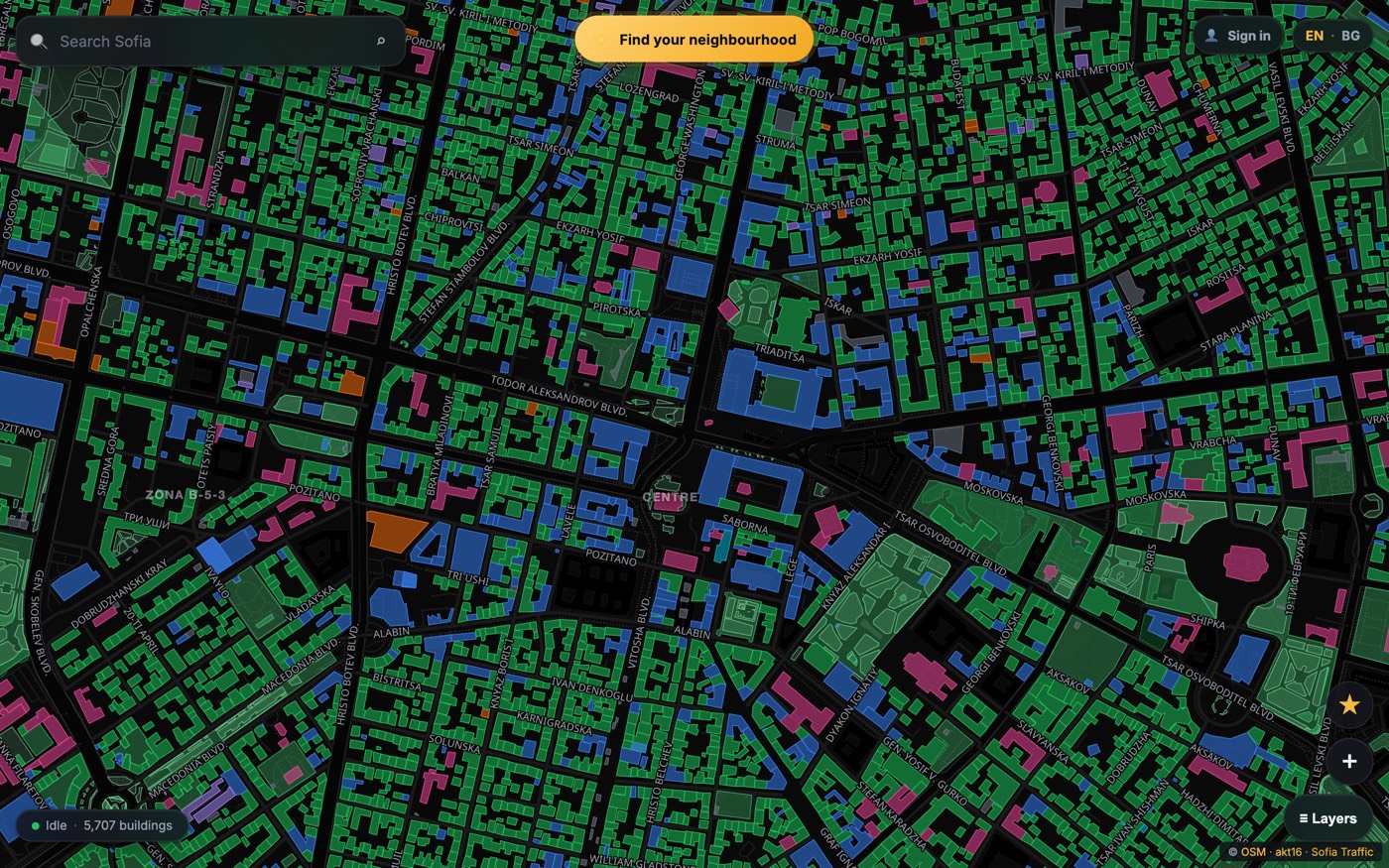
One map, three ways to use it
Choosing a neighbourhood is a different question for a renter, a buyer and an investor. The data underneath is the same; the map lets each of you weigh it your way.
Renting
Median rents per neighbourhood from live listings, a best-value ranking that weighs rent against liveability, and a quiz that can filter to areas under your monthly budget.
rent data in Sofia ProBuying
Asking prices per m², development pressure computed from active building permits, and the second budget rarely quoted upfront: finishing a new build adds €36,000–77,000 to the sticker price.
price data in Sofia ProInvesting
Gross rental yield per neighbourhood, a value score that flags areas priced below their liveability, and honest analysis of what off-plan buying does to returns.
yield data in Sofia ProWhat the neighbours would tell you
We read thousands of public forum discussions about Sofia's neighbourhoods and distilled them into a community sentiment score, with summaries for families, young professionals and commuters. Every summary links to the threads it was read from.
In some neighbourhoods, the statistics and the people who live there disagree by up to 42 points out of 100. The map shows you both sides before you sign anything.
Where the data comes from
Every score on the map traces back to a public source, and every neighbourhood card explains its own methodology.
Numbers nobody quotes you at the viewing
Research pieces built from the same data that powers the map.
Free to explore. Pro when money is on the line.
The map, the scores and the quiz stay free. Sofia Pro adds the money signals for the months you are actually deciding, and you can cancel in two clicks when you are done.
- Interactive 2D and 3D map of all 236 neighbourhoods
- Liveability scores and written profiles for every hood
- 60-second matching quiz
- Side-by-side neighbourhood compare
- Building permit pins on the map
- All data stories and articles
- Buy and rent prices per m² for every neighbourhood
- Gross rental yield and value score
- Best-value and community-sentiment rankings
- What locals say: summaries with linked sources
- Budget filter in the quiz, with real rent estimates
- Development-pressure reading per neighbourhood
- Pro rows in compare: rent, yield, value, sentiment